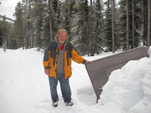
January 14, 2012, solo hike in Police Outpost Provincial Park.
During my drive to Waterton Park a few days earlier I noticed the sign for Police Outpost Park. The last time I was to Police Outpost Park was in September of 2005, and I walked the trail to the International Boundary and past the Outpost Wetlands. A very contemplative and reflective walk as I recall. Having walked the trail before I had a good idea how far the walk would be.
When I got to the park the wind was blowing hard but relatively warm. There was a bit more snow on the ground than I anticipated but then this park is above 4000 feet so more snow would be expected. The park gate was closed so I parked at the gate and went on foot into the park. It is less than 2 kms to walk to the International Boundary marker. One benefit of snow is when someone or something passes by they leave tracks. I could see from the tracks that a couple of people had been on that path earlier in the day, or the day before for sure.
By the time I had finished the walk to the boundary marker and returned on the trail along the wetland it was just around noon so I decided to go down the path and take a look at Police Outpost Lake. I rested on a bench there and had a snack. So far the hike had been easy but trust me to start out on an easy walk and make it more difficult. I wasn't ready to go home yet so I continued my walk by following the lake shore. I could walk along the shore on lake ice and snow some of the way but on the easterly side of the lake the snow drifts became too deep because of the prevailing winds. I seeking easier walking I moved onto the shore and even up onto the high bank. This involved quite a bit of walking on rough uneven ground, over trees and through crusted snow. It started to take a toll on my feet but I managed to walk around the entire lake. I also walked the causeway out to the island and then walked to the other side of the island. I was walking a short section of the shore line of the Island when I flushed a Goshawk out of the willows. It was only visible momentary before it, true to it's secretive nature, banked back into the willows and disappeared. The only other wildlife that I saw were two Whitetail Deer on the boundary marker trail. There were, however, lots of tracks of the ubiquitous coyote and a few grouse tracks on the island.
Distance was about 11 km.
3 hr. 36 min moving. 42 min stopped.
Total ascent 1722 (the total ascent seems to be too much), max elev. 4793.
Foot Note: As I approached the International Boundary there is a barbed wire fence and the path goes through a stile to allow access to the marker. At the style there is a post that once held a sign but the sign has been removed, likely by vandals. One of the signs had the following message: "Proceeding beyond the International Boundary Marker is against the law. Visitors to the United States must enter through a legal point of entry ( Carway or Chief Mountain Border Crossing)". Needless to say I did not proceed further south than the marker, even though I was carrying a current Canadian Passport.
Do you believe the Alberta-Montana border is exactly on the 49th parallel? I can say that when I was on the Boundary Marker I was at at latitude N48^ 59' 52.7" and the 49th Parallel was about 200 metres north of where the marker is. I have a small book explaining why this is so. The book is Alberta's 49th Parallel A Natural History and Journey by Johan Dormaar.


No comments:
Post a Comment