Thursday, January 26, 2012

Setting Boundaries

January 14, 2012, solo hike in Police Outpost Provincial Park.

During my drive to Waterton Park a few days earlier I noticed the sign for Police Outpost Park. The last time I was to Police Outpost Park was in September of 2005, and I walked the trail to the International Boundary and past the Outpost Wetlands. A very contemplative and reflective walk as I recall. Having walked the trail before I had a good idea how far the walk would be.

When I got to the park the wind was blowing hard but relatively warm. There was a bit more snow on the ground than I anticipated but then this park is above 4000 feet so more snow would be expected. The park gate was closed so I parked at the gate and went on foot into the park. It is less than 2 kms to walk to the International Boundary marker. One benefit of snow is when someone or something passes by they leave tracks. I could see from the tracks that a couple of people had been on that path earlier in the day, or the day before for sure.

By the time I had finished the walk to the boundary marker and returned on the trail along the wetland it was just around noon so I decided to go down the path and take a look at Police Outpost Lake. I rested on a bench there and had a snack. So far the hike had been easy but trust me to start out on an easy walk and make it more difficult. I wasn't ready to go home yet so I continued my walk by following the lake shore. I could walk along the shore on lake ice and snow some of the way but on the easterly side of the lake the snow drifts became too deep because of the prevailing winds. I seeking easier walking I moved onto the shore and even up onto the high bank. This involved quite a bit of walking on rough uneven ground, over trees and through crusted snow. It started to take a toll on my feet but I managed to walk around the entire lake. I also walked the causeway out to the island and then walked to the other side of the island. I was walking a short section of the shore line of the Island when I flushed a Goshawk out of the willows. It was only visible momentary before it, true to it's secretive nature, banked back into the willows and disappeared. The only other wildlife that I saw were two Whitetail Deer on the boundary marker trail. There were, however, lots of tracks of the ubiquitous coyote and a few grouse tracks on the island.

Distance was about 11 km.

3 hr. 36 min moving. 42 min stopped.

Total ascent 1722 (the total ascent seems to be too much), max elev. 4793.

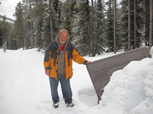
Foot Note: As I approached the International Boundary there is a barbed wire fence and the path goes through a stile to allow access to the marker. At the style there is a post that once held a sign but the sign has been removed, likely by vandals. One of the signs had the following message: "Proceeding beyond the International Boundary Marker is against the law. Visitors to the United States must enter through a legal point of entry ( Carway or Chief Mountain Border Crossing)". Needless to say I did not proceed further south than the marker, even though I was carrying a current Canadian Passport.

Do you believe the Alberta-Montana border is exactly on the 49th parallel? I can say that when I was on the Boundary Marker I was at at latitude N48^ 59' 52.7" and the 49th Parallel was about 200 metres north of where the marker is. I have a small book explaining why this is so. The book is Alberta's 49th Parallel A Natural History and Journey by Johan Dormaar.

Tuesday, January 24, 2012

On The Beaten Track

January 8, 2012, walked with my granddaughter on Pothole Creek in Magrath.

During the first months of 2008 I took regular walks along Pothole Creek in Magrath. Sometimes I would walk alone and sometimes I would walk with my sister and brother in law. I had intended to return and do the walk again but never quite managed it until this walk. There has been some recent maintenance and construction on the trail.

This is a relatively short walk but pleasant with a bit History and natural history. To get access to the trail drive south on South 1st Street W and on the east side of the Covered Wagon Campsite there is a sign for Nature Trail users to park there. Watch for the placard about the settlers named Dudley and about the Irrigation head works. There is also a sign saying that Leopard Frogs have been reintroduced to this creek. Perhaps I will return in the spring or summer see or listen for the frogs.

Distance walked 2.78 km

54 min moving. 3 min stopped

Max elevation 3233ft.

****

January 12, 2012, solo walk in Lethbridge.

Often when I have some spare time I will take a walk. If I walk solo then I will ponder and reflect on some of my 'conundrums of life'. Such was the case on this day. I had no specific destination or route. I started my walk at 2 ave. near the Galt Museum because there was a place to park on the street there. I followed the paved walking path down to the Fort Whoop-up Museum.

I have walked this way a few times before and I made a Blog entry about it in April 2009. I walked the Indian Battle Park and under the the huge Lethbridge railway trestle. There were no beaver splashing about this time but there were Canada Geese still on the river. When I walk in the winter there are fewer people on the trails so winter walks are more solitary.

On this walk I went by the Helen Schuler Nature Centre. It was closed but the nature centre organizes various events. To check out what is on the schedule go to: http://www.lethbridge.ca/Things-To-Do/Nature-Centre/Pages/default.aspx

Approximate distance 5.5 km

Time was about 2 hours.

No matter where I am there is always a path to follow and places to explore.

Wednesday, January 11, 2012

Waterton Wind and Wildlife

January 7, 2012, Hike to Bertha Falls in Waterton National Park.

I only have to be as close as Lethbridge, AB when the Sirens of the Waterton National Park mountain trails begin to ply their powers on me. As a mistress lures her lover to her bedside, so am I lured to the trails of the Waterton mountain trails. With the January temperatures in the pluses, resistance is all the more futile. Saturday morning dawned with wind warnings in effect for Southwestern Alberta, but I concluded that if the wind wasn't toppling mountains over then it would be okay to be out hiking. Indeed it was windy, so much so that my poor beater vehicle seemed at times to be more of a sail than any kind of conveyance, but we made it.

Yes WE made it, My grandson and granddaughter were keen to join me. Having them join me delayed my departure a little and necessitated a shorter hike. Last summer we had hiked to Bertha Lake, note my Blog of July 4, 2011, so they were familiar with the trail, making Bertha Falls the trail of choice for this afternoon's hike.

We were on the trail by about 1:30 PM. There was a bit of snow on the trail, but not enough to inhibit walking. The icy patches were more of a consideration and the more cautious hiker may want to consider wearing cleats. Indeed, we did encounter a pair of hikers who had small snow shoes with cleats on the bottom. These seemed to me to be useful equipment to have along.

Walking in the wind went well; however, even with temperatures above zero, the wind will make you will feel cold, so on a hike like this it makes good sense to wear or carry extra clothing. As long as we were moving we were warm but when we stopped the wind would penetrate it's coldness into us. Needless to say after about an hour of walking when we decided to stop for a snack and a drink we sought the shelter of the deeper woods for protection from the persistent wind. A short way after our break the trail took us within view of Bertha Creek. Even in winter the sight and sound of running water seems to stir the soul feel the pleasure of place and time. Open moving water against ice and snow sculpts the stream and shapes it into sights and sounds that you will only see and hear on winter walks.

In winter everything is seems quieter. Blankets of snow and the encasement of ice have all but subdued Bertha Falls. The rushing rough and tumble summer falls are now mostly hidden and muffled, but they still manage to briefly appear with a quiet swish and then disappear again into the catacombs of ice and snow. We only tarried long enough to snap a few photos, remembering how soon the light of winter days can fade away.

The hike back seems short. I point out latent tracks, in the snow, of coyote, squirrel and even tracks that might have been left by a marten. In spite of the fact that this is a winter hike the conversation turns to bears. Waterton Park is populated with Black Bear and Grizzly and it is common to see bears while hiking in the park, but never in the winter.

At the parking lot the wind and the surf on Waterton Lake bade us to take a stroll along it's shore. Stones covered by ice, and ice shaped by stones; surf and wind all combined into a unique winter park experience.

Total distance 6.6 km.
2hr 5 min moving, 25 min stopped.
Total ascent 1286 ft. maximum elev. 4771 ft

Foot note: My notes about the hike to Bertha Lake, with Ken on Feb. 15, 2011, show 1 hr 22 min moving and 35 min stopped going to the falls and 1 hr 6 min moving 33 min stopped when returning from the falls. About 3hr 40 min in total. So the kids and I did it a lot faster likely due to much better walking conditions on the trail.


Monday, January 9, 2012

More Mill Creek

January 2, 2012, Walked the Lower end of Mill Creek to the Muttart Conservatory and back.

The Monday after New Years was another day of fair weather and a good day for a walk so it took no more than a suggestion from a friend to persuade me to go. I have walked the Mill Creek Ravine a few times lately but there is always something there to capture my interest. This time the walk took my friend and I to the lower end of the ravine then across Connors Road and over to the Muttart Conservatory. There is a small ski hill in this area and I think the park is called Gallager Park. As we walked along the lower end of the park I realized that it was at this park, back in the 70's, where I went sliding a few times. I had memories of those times but I had pretty much forgotten where it was that I had been. So the lights went on, so to speak. I did quite a bit of reminiscing during that part of the walk.

On the way back we got on the south side of the Connors Road and into some interesting terrain. There were no trails, just tracks to follow through the trees. Eventually the tracks dispersed and the terrain pushed us back to Connors Road so we crossed it and walked the upper end of Gallager Park. A couple of Crazy Carpets left at the top of the hill were a serious temptation to try sliding but we spotted the probable owners on the hill and thought better of helping ourselves to a ride.

We eventually worked our way back up to the top of the ravine which took us a short way through a residential area and then back down into the ravine.
This was a nice walk and a chance to visit and revisit the less travel parts of Edmonton. For me this is a pleasant way to spend an afternoon.

I estimate the walk at about 5.5 km. we did it in about 2 hours time.

Saturday, January 7, 2012

Social Walking

January 1, 2012, Meet up walk, Highlevel bridge Hawreluk Park, U of A, 109 st.

Is there a better way to start out the new year than by doing a walk? I did this walk with seven other people and I know for certain that there was at least one New Year's resolution being honored by going on this hike, and very likely more than one. Besides, the day was pleasant and not too cold, which made being out and about all the more appealing. A topic of conversation on this walk was 'group walking', or what I have entitled, 'social walking'. Personally, I find a distinct pleasure in walking and chatting. I believe that the increase in blood circulation created by the exertion of walking also stimulates one's mind, therefore, conversations, in my opinion, are more stimulating while walking, than when sitting still. I also find walking alone is a time for me to reflect and contemplate, but I learned from the conversations on this walk, that few or none of the other people in the group like to walk alone. If you have read my past Blog entries you will know that I do many of my hikes and walks solo. I am very comfortable being out on my own and I have even done some fairly extreme hikes solo. Yet I rarely give this type of solitary activity a second thought. It will also come as no surprise when I say that among one's circle of friends, a person might not have even one friend who wants to hike or walk with you. However, if you live in Edmonton there are a number of groups and organizations that bring people together in an organized walk.
There are two Meetup groups I have found that are dedicated to walking on a regular basis: Fit & Active 50 + or - Meetup Group has a regular Sunday afternoon hike and Edmonton Hiking/Walking Meetup Group organize walks on Thursday evening and Saturday morning. There is also the New Edmonton Outdoor Club. These are the groups I know about but I am sure there are quite a few more out there.

Total km about 12
Time was about 3 hours 30 min.
1:30 pm to about 5 pm
Maximum elevation 2819

Before I post this entry there is one other thing that I want to also mention. Several members of the walking groups I walk with have cleats that can be fastened to their walking shoes. These are to prevent slipping and falling on icy surfaces. As a result of the freeze thaw weather that Edmonton has had there is ice everywhere and these cleats are a valuable piece of equipment. They range in price form about $20 to $50. I don't use them but I still consider them as money well spent by those who do use them.

Wednesday, January 4, 2012

Closing of 2011

As it turns out my walk to the north shore of Cold Lake on December 29 was my last hike in 2011. By the end of that hike I had logged 588 km, more or less, in 2011. Mostly more because as I mentioned in earlier Blogs I have not logged every km that I have been in motion under my own power. There are several times when I have walked just to get some place in the city and I have not kept any log of that walk. Also not all of these km's were logged by hiking as I included distances travel on a bicycle or in a canoe or kayak or even on skates.
The purpose of this undertaking is not about numbers though. My purpose is to provoke any readers of this Blog to get in motion. In 2012 I intend to continue to log my kilometers traveled but I want to focus your/the readers attention more on how rich and fulfilling the outdoor experience can be when it includes some physical excursion.
This is where I would like you, the reader, to give me some feed back. I intend to continue to enthusiastically Blog about my outdoor experiences but if there are details that I need to include then only your feedback and constructive criticism will make me aware of it.
My hope is that by the end of 2012 I will have gone further faster and higher, anyone want to join me?

Monday, January 2, 2012

Snow Walks and Winter Beachs

December 29, 2011, solo Walk North side of Cold Lake, Cold Lake Provincial Park, part 2

When I did my last hike in this area I hoped to walk to the mouth of the Martineau River so I began this hike, once again, with a notion to attempt to complete that walk. However, I started my walk a later than and the distance was further than I expected; but as walks go, this turned out to be one of my better ones of the year.

All the same, I got started well before noon. My plan was to walk 2 hours 30 minutes, then take a break and return. This hike involved a variety of terrain as I started out on a well traveled vehicle trail but also did some of the walk in bush with no trail.
The relief in the terrain, particularly at the drainage crossings, and several inches of snow in the bush and on the trail made this a moderately difficult hike.
Judging from the game trails and tracks in the snow on the park trails this area is frequented by deer, moose and coyote as well as the common small mammals and ruff grouse.
It was a calm day and the temperature was just below zero, which made it a pleasant walk. About two hours into the hike it started to snow lightly and a breeze came up from off the lake. About that time the trail took me within view of the lake, so I left the trail and walked for a while on the beach.
Although my view was partially shrouded by falling snow, I could tell that less than 100 meters out from shore, the lake was not yet frozen. The breeze on the open water was producing swells that gently rose and fell until they were absorbed into the margin of broken ice and slush. The whole process was remarkably silent. This place was a silent world sketched in hues of gray. Dark water rising and falling, white snow, mist, even the willow and polar trees were but dark and light vertical lines in shades of gray. These are impressions that can only be experienced in the soft light of a low winter sun shrouded by mist and snow. Not an eerie experience by any means, I found it peaceful and calm.
I walked until 2pm. The snow fall had become heavier, so I stopped under a few snow-laden spruce trees for shelter and, on my stove, warmed some lunch to eat. After eating, I immediately packed up and started back. For the walk back I used my trekking poles. The poles seemed to help reduce the effect of the extra effort needed to walk in the snow on the trail.
Presently the snow stopped. Now, with a fresh cover of snow, every animal track was new. I soon saw fresh coyote tracks that came halfway across the trail and then turned back. If I have read the tracks right, that coyote had been there only minutes before me. Aware of my presence, it interrupted it's planned route and returned the way it came.
The sky cleared and the sun got low. The low sun cast its pinkish hues onto a few broken clouds. The trees and the sky were now cloaked in the soft pink hues that only winter sunsets can produce.
More fresh tracks of squirrels and a weasel.
By the time the sun got below the horizon, I still had about an hour of ground to cover before I would reach my truck. I was thankful for the long winter twilight, but it was disappearing too quickly. To top it off, my GPS batteries were dying. I dug a flashlight out of my pack and used it to illuminate my GPS, rather than use any precious GPS battery power to back-light the screen. I made it back through the brush in winter twilight, using landmarks and the GPS to help me find my way. By the time I found the last trail leading back to my vehicle, a thin crescent moon was casting faint shadows of spindly trees trunks, blended with a faded shadow of me, onto the shimmering cover of fresh snow.
I arrived at the truck with wet feet and a sweaty back from so much continuous activity, yet I was filled with warm contentment from such success in the day's excursion.


Distance was about 17 km.
Moving time 5 hours 6 min.
Stopped time 49 min stopped
Max elev 1971.

Sunday, January 1, 2012

Trekking on Ice and Snow

Dec. 27, 2011, solo walk on Long Bay (Cold Lake).

I parked in the beach parking lot of the Cold Lake Provincial Park and I started my walk from there. I took the most direct route to Long Bay which took me past the park sewage disposal facility and then down a bit of a bank to the bay.
I always proceed with some caution when venturing onto unfamiliar ice but seeing snowmobile tracks on the edge of the bay gave me considerable confidence. There is not much snow this year so there are large areas where the wind has kept the snow swept of off the ice. Clear ice looks black or dark and you can look down into it. There are always fractures, bubbles, or plant material in the ice which will give some perspective as to how thick the ice is. I estimated the ice on the bay to be about 1 foot thick.
On my walk I noticed a mound of dark material piled on the ice and I suspected it to be a muskrat ‘push up’. A 'push up' is plant material that a muskrat brings up from the bottom of the lake and pushes through a hole in the ice into a mound on the top of the ice. The mound insulates the hole in the ice which keeps the hole from freezing over and thus providing a place for the muskrat to surface for a breath of air. By working my trekking pole carefully through the mound of plant material I confirmed there was indeed an open hole beneath it.
Where possible I stayed to the edges of the bay where there was wind packed snow to walk on. It is much easier to to walk on the snow. There were also fresh tracks of the ubiquitous coyote in the snow. I suspect the coyote had passed that way earlier that day.
One objective of my walk was to go to a small island in long bay. I do not wear any ice cleats on my boots so on this day I relied on my trekking poles to provide added stability. I did slip a couple of times so I practice adjusting my centre of balance and the position of the poles as I walked. I seemed to find a method of walking that gave me reasonable stability on ice so I did not fall this time. On my course to the island I saw 2 ravens flying by, a fair distance away, who seemed to be engaged in a dispute.
As I approached the island I voluntarily walked on the clear 'black' ice just to observe the shapes and patterns frozen into it. The day was calm and hence conditions were perfect for walking in exposed areas like this. As I observed interesting patterns of bubbles and fractures I noticed curious patterns of tiny bubbles. The bubbles were always n a looping or even a spiral shape as though they were held by a filament much like a string of beads. No filament was visible. A curiosity indeed.
When I got to the island I walked around it and then took a break. I used my camp stove to heat up some lunch.
It seems that I didn't Blog much in 2010 but I have notes from last year and the last time I was to this island was on Dec. 25, 2010. On that day as I skied to the island and in one place I had to alter my course because I was breaking through the snow into water under the snow. I have encountered water on the top of the lake ice but under the snow cover before. It generally happens when there is a heavy snow fall early in the season. On this walk I used my GPS to track back on that same place where I had encountered the water. The place has lots of ice this year. Beyond that at the point of land at the mouth of Long Bay, where I had started my ski on Long Bay last year, there was open water that part of the route I had skied last Dec. 25 was all open water this year.
Since I could not walk on water I walked the beach and then I got onto the walking/skiing trail back to the park road. About this time there was a gentle snow falling. There is something serene about snow falling on a calm afternoon that invokes a calmness in ones soul. The short winter daylight was beginning to already dim so I took the direct walking/ski trail back to the parking lot.
With the sky now clear I observed the first crescent moon after the new moon and a planet as a drove south on my way home. A fitting close to a good day.

Total distance 8.87 km.
Moving time 2 hr. 47 min.
Stopped about 40 min.
Max elevation, 1926 ft.