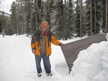
April 27, 2012, hike Birdseye Butte with my brother.
When my brother and I set out we did not have a clear idea of where we were going. We ended up on the Chief Mountain Highway in the east side of Waterton National Park. I had my topographical map of Waterton Park and I was checking trails and landmarks as my brother drove. We found that the highway on the east side of the Blood Reserve was barricaded so we were not able to explore any of the trails beyond there. On our way that far a butte had caught our attention and I checked the name on my map. It was Birdseye Butte. After we turned back at the barricade we decided to hike up Birdseye Butte.
Since Birdseye Butte is outside of the park boundary there is no marked trail. We first looked for a trail at the, near by, park picnic site along the highway but found no trail there, so we drove a little further west to where there seemed to be an old road. We did not really find a road or a trail but we found the walking was fairly easy. When we got a gate in the barbed wire fence at the park boundary we found a bit of a trail but we soon lost that trail again. However it wasn't long until we came across a well used vehicle trail which took us up the butte.
The day before this hike my brother became a great grandfather, and I read an article in National Geographic about Gerlinde Kaltenbunner's ascent of K2 without oxygen:
 http://events.nationalgeographic.com/events/speakers/2013/03/14/k2-la/
As my brother and I hiked up the trail and the slope steepened I joked that we were climbing the butte without oxygen. We stopped for lunch on top of the butte.
I found an elk antler, we saw 2 whitetailed deer and a flock of blue birds. I photographed crocus and prairie shooting stars. On the way back down we noticed deer and bovine bones in the area of the dam. On the way back we went around the west side of the lake/reservoir. We followed a trail made by a Brush Hog and we may have found some latent bear tracks. The hike got more 'interesting' when the trail vanished and we decided to walk across marshy area. It wouldn’t be a hike if I didn't get my feet wet and wading across that marsh accomplished that. We got back to the van at about 3 PM.
Distance: 8.42 km.
Time: 3 hr. 13 min. moving, 45 min stopped.
Ascent: 379 M, max. elev. 1635 M

No comments:
Post a Comment