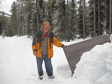
December 7, 2011, Solo Walk in Cold Lake Provincial Park, North side of Cold Lake.
This is not new territory to me but it seems like new territory since most of my memories of this area are from the summer of 1974. I had a summer job with Alberta Fish and Wildlife and I traveled this area. Back then the area was vacant land and not part of a provincial park. I am not sure when it was made a provincial park but I believe that this could be my first visit to the area since it was made a park. I was not expecting to be walking in a park. The approach where I turned off the Primrose Highway, where I started my walk, was pretty much as I remembered it. The first 700 m was on a limited use road which apparently has a lot of 4 wheel drive, ATV, and snowmobile traffic but then there is a vehicle barricade and I continued my walk in the park on and old vehicle trail. I walked for about for 600 m and then I left the trail. I had a notion to walk as far as I could toward the Martineau River and through the bush was the most direct route. I found it still fairly easy walking. In 1.5 km at around 2 pm I intersected another old vehicle track. I decided to take a break and that this was a good place to turn back. There was a very light dusting of new snow so conditions were good for identifying tracks. There were the usual tracks of Red Squirrel and small rodents. There were a number of fresh deer tracks and coyotes. I also found 2 or 3 sets of grouse tracks. After I turned back I saw a Pine Grosbeak. After I turned back I followed the trail and found that this trail is maintained by the park personnel, nevertheless there were a few new blow down trees on the trail. The trees posed no obstacle to me on foot but they might to a cyclist or skier. I stayed on this trail to walking west for 2.3 km. This trail appears to be the main route through this part of the park. My GPS map showed another trail going generally north and I had chosen this as my route back to my vehicle. This trail is entirely over grown with trees. There are the distinct marks where vehicle ruts were worn into ground but there are now what appear to me to be 30 year old spruce trees growing in the ruts. The trail is not discernible at all in the area of an old beaver dam. If I had not been following a feature outlined on my GPS map then I would have likely lost it altogether, but with the aid of my GPS I was able to stay on the old track and there were the occasional discernible vehicle ruts to verify that there had indeed been a trail there at one time. It was curious to me that in one place there were mostly spruce trees growing in the old trail while aspen was the predominate cover every where else. Clearly the old trail had been seeded to spruce trees or there was some aspect of the vehicle travel on the trail which promoted the germination of White Spruce trees. I followed this over grown trail 1.7 km. back to my vehicle. It was about -10 C with a stiff wind but once I got into the shelter of the trees and as long as I was walking the temperatures were quite tolerable.
7.2 km
2 hours 30 min moving.
43 min stopped.
Max elevation 1968 feet.

No comments:
Post a Comment