Showing posts with label winter hike. Show all posts

Thursday, January 26, 2012

Setting Boundaries

January 14, 2012, solo hike in Police Outpost Provincial Park.

During my drive to Waterton Park a few days earlier I noticed the sign for Police Outpost Park. The last time I was to Police Outpost Park was in September of 2005, and I walked the trail to the International Boundary and past the Outpost Wetlands. A very contemplative and reflective walk as I recall. Having walked the trail before I had a good idea how far the walk would be.

When I got to the park the wind was blowing hard but relatively warm. There was a bit more snow on the ground than I anticipated but then this park is above 4000 feet so more snow would be expected. The park gate was closed so I parked at the gate and went on foot into the park. It is less than 2 kms to walk to the International Boundary marker. One benefit of snow is when someone or something passes by they leave tracks. I could see from the tracks that a couple of people had been on that path earlier in the day, or the day before for sure.

By the time I had finished the walk to the boundary marker and returned on the trail along the wetland it was just around noon so I decided to go down the path and take a look at Police Outpost Lake. I rested on a bench there and had a snack. So far the hike had been easy but trust me to start out on an easy walk and make it more difficult. I wasn't ready to go home yet so I continued my walk by following the lake shore. I could walk along the shore on lake ice and snow some of the way but on the easterly side of the lake the snow drifts became too deep because of the prevailing winds. I seeking easier walking I moved onto the shore and even up onto the high bank. This involved quite a bit of walking on rough uneven ground, over trees and through crusted snow. It started to take a toll on my feet but I managed to walk around the entire lake. I also walked the causeway out to the island and then walked to the other side of the island. I was walking a short section of the shore line of the Island when I flushed a Goshawk out of the willows. It was only visible momentary before it, true to it's secretive nature, banked back into the willows and disappeared. The only other wildlife that I saw were two Whitetail Deer on the boundary marker trail. There were, however, lots of tracks of the ubiquitous coyote and a few grouse tracks on the island.

Distance was about 11 km.

3 hr. 36 min moving. 42 min stopped.

Total ascent 1722 (the total ascent seems to be too much), max elev. 4793.

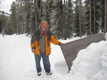
Foot Note: As I approached the International Boundary there is a barbed wire fence and the path goes through a stile to allow access to the marker. At the style there is a post that once held a sign but the sign has been removed, likely by vandals. One of the signs had the following message: "Proceeding beyond the International Boundary Marker is against the law. Visitors to the United States must enter through a legal point of entry ( Carway or Chief Mountain Border Crossing)". Needless to say I did not proceed further south than the marker, even though I was carrying a current Canadian Passport.

Do you believe the Alberta-Montana border is exactly on the 49th parallel? I can say that when I was on the Boundary Marker I was at at latitude N48^ 59' 52.7" and the 49th Parallel was about 200 metres north of where the marker is. I have a small book explaining why this is so. The book is Alberta's 49th Parallel A Natural History and Journey by Johan Dormaar.


Wednesday, January 11, 2012

Waterton Wind and Wildlife

January 7, 2012, Hike to Bertha Falls in Waterton National Park.

I only have to be as close as Lethbridge, AB when the Sirens of the Waterton National Park mountain trails begin to ply their powers on me. As a mistress lures her lover to her bedside, so am I lured to the trails of the Waterton mountain trails. With the January temperatures in the pluses, resistance is all the more futile. Saturday morning dawned with wind warnings in effect for Southwestern Alberta, but I concluded that if the wind wasn't toppling mountains over then it would be okay to be out hiking. Indeed it was windy, so much so that my poor beater vehicle seemed at times to be more of a sail than any kind of conveyance, but we made it.

Yes WE made it, My grandson and granddaughter were keen to join me. Having them join me delayed my departure a little and necessitated a shorter hike. Last summer we had hiked to Bertha Lake, note my Blog of July 4, 2011, so they were familiar with the trail, making Bertha Falls the trail of choice for this afternoon's hike.

We were on the trail by about 1:30 PM. There was a bit of snow on the trail, but not enough to inhibit walking. The icy patches were more of a consideration and the more cautious hiker may want to consider wearing cleats. Indeed, we did encounter a pair of hikers who had small snow shoes with cleats on the bottom. These seemed to me to be useful equipment to have along.

Walking in the wind went well; however, even with temperatures above zero, the wind will make you will feel cold, so on a hike like this it makes good sense to wear or carry extra clothing. As long as we were moving we were warm but when we stopped the wind would penetrate it's coldness into us. Needless to say after about an hour of walking when we decided to stop for a snack and a drink we sought the shelter of the deeper woods for protection from the persistent wind. A short way after our break the trail took us within view of Bertha Creek. Even in winter the sight and sound of running water seems to stir the soul feel the pleasure of place and time. Open moving water against ice and snow sculpts the stream and shapes it into sights and sounds that you will only see and hear on winter walks.

In winter everything is seems quieter. Blankets of snow and the encasement of ice have all but subdued Bertha Falls. The rushing rough and tumble summer falls are now mostly hidden and muffled, but they still manage to briefly appear with a quiet swish and then disappear again into the catacombs of ice and snow. We only tarried long enough to snap a few photos, remembering how soon the light of winter days can fade away.

The hike back seems short. I point out latent tracks, in the snow, of coyote, squirrel and even tracks that might have been left by a marten. In spite of the fact that this is a winter hike the conversation turns to bears. Waterton Park is populated with Black Bear and Grizzly and it is common to see bears while hiking in the park, but never in the winter.

At the parking lot the wind and the surf on Waterton Lake bade us to take a stroll along it's shore. Stones covered by ice, and ice shaped by stones; surf and wind all combined into a unique winter park experience.

Total distance 6.6 km.
2hr 5 min moving, 25 min stopped.
Total ascent 1286 ft. maximum elev. 4771 ft

Foot note: My notes about the hike to Bertha Lake, with Ken on Feb. 15, 2011, show 1 hr 22 min moving and 35 min stopped going to the falls and 1 hr 6 min moving 33 min stopped when returning from the falls. About 3hr 40 min in total. So the kids and I did it a lot faster likely due to much better walking conditions on the trail.


Thursday, December 29, 2011

Trekking Poles Tryout

Dec. 19, 2011, Trekking Pole Try Out. Walked solo from William Hawrelak Park east along the south river breaks to the Whitemud Freeway bridge and back.

While hiking to Raven Lake and Grizzly Den back in October, and on previous hikes as well, my brother brought Trekking Poles. Before he got the trekking poles this he often used a walking stick or staff. I have usually resisted using a walking stick. Some of my reasons why I have resisted are because I am forgetful and so often leave my walking stick somewhere or I forget to bring it, I have also found that a walking stick can be a great asset on some terrain but in other situations it can quickly become a liability. On a few hikes now I have borrowed one of my brother’s trekking poles, usually to descend steep and difficult sections of the trail and I have to recognize that a trekking pole clearly gives any hiker greater stability. A staff or a walking stick also aids whit stability but what I came to realize is that the retractable trekking poles can be collapsed and put away in a backpack when they are not needed thus eliminating the nuisance of having to carry them when you are not needing to use them. This one feature alone convinced me to make trekking poles a part of my hiking equipment.
Today I bought trekking poles at MEC. I bought Komperdell poles because they were marked down to $66. That seemed like a bargain so how could I resist. This afternoon I went on a hike to try them out. I started at William Hawrelak Park and I hiked the east and south river breaks to the Whitemud Freeway bridge where I crossed to the north river breaks and returned from west along the river. As I there is variety in the terrain on this walk it was a good choice. I met a guy carrying a camera and with an impressive telephoto lens. I stopped to chat with him and in the course of our conversation I learned about the types of woodpeckers that frequent these areas and I heard the word leucism, reduced pigmentation particularly in birds, for the first time, or not that I recall at least.
I noted many signs or portions of this route warning of dangers and to stay off the trail but there were lots of foot prints going where the signs said not too so I followed the people tracks on through these posted areas. On my return walk I ended up in the off leash area so I encountered many dogs. One or two dogs seemed mildly intimidated by the trekking poles.
For the most part the trekking poles worked out well.

Distance walked about 10 km.
Moving time 2 hr. 35 min. stopped time 18 min.
total acsent 536. max elev 2338

Ice Walking

Dec. 17, 2011, I walked on Islet Lake with my nephew Dave.

We started out for the Central Staging in the Cooking Lake Recreation Area, but I missed a turn and we ended up at Islet Lake anyway. The first place we walked was over to the lake to check it out and we decided to walk over to the main island. We explored the large island some of the smaller islands. We observed one interesting ice heave between an Island and a point of land. The ice on the lake appeared to be 1 foot thick. There were areas with no snow cover and areas with no snow cover. Walking on the snow covered areas was quite easy but the clear areas were slippery so we barely averaged 2 km/hr. I fell down once.

Distance walked was 4 km
Moving time 1 hour 45 min.


Dec. 18, 2011, Walked Mill Creek in Edmonton with a friend.

We started out at 93 st. and 69 ave. Walked around the south side of the residence in the ravine bottom (89th Ave.) at about N53 30 46.8 W113 28 18.1. Along the trail there was a tree that had been chopped down. On our return we took a little different route and missed the tree so we back tracked to it so we could salvage some twigs off of it. On the way back we found Christmas ball ornaments hung in the trees and took photos.

Total distance 9.3 km
Total time about 2 to 2.5 hours

Monday, December 26, 2011

Cold Lake Provincial Park North

December 7, 2011, Solo Walk in Cold Lake Provincial Park, North side of Cold Lake.


This is not new territory to me but it seems like new territory since most of my memories of this area are from the summer of 1974. I had a summer job with Alberta Fish and Wildlife and I traveled this area. Back then the area was vacant land and not part of a provincial park. I am not sure when it was made a provincial park but I believe that this could be my first visit to the area since it was made a park. I was not expecting to be walking in a park. The approach where I turned off the Primrose Highway, where I started my walk, was pretty much as I remembered it. The first 700 m was on a limited use road which apparently has a lot of 4 wheel drive, ATV, and snowmobile traffic but then there is a vehicle barricade and I continued my walk in the park on and old vehicle trail. I walked for about for 600 m and then I left the trail. I had a notion to walk as far as I could toward the Martineau River and through the bush was the most direct route. I found it still fairly easy walking. In 1.5 km at around 2 pm I intersected another old vehicle track. I decided to take a break and that this was a good place to turn back. There was a very light dusting of new snow so conditions were good for identifying tracks. There were the usual tracks of Red Squirrel and small rodents. There were a number of fresh deer tracks and coyotes. I also found 2 or 3 sets of grouse tracks. After I turned back I saw a Pine Grosbeak. After I turned back I followed the trail and found that this trail is maintained by the park personnel, nevertheless there were a few new blow down trees on the trail. The trees posed no obstacle to me on foot but they might to a cyclist or skier. I stayed on this trail to walking west for 2.3 km. This trail appears to be the main route through this part of the park. My GPS map showed another trail going generally north and I had chosen this as my route back to my vehicle. This trail is entirely over grown with trees. There are the distinct marks where vehicle ruts were worn into ground but there are now what appear to me to be 30 year old spruce trees growing in the ruts. The trail is not discernible at all in the area of an old beaver dam. If I had not been following a feature outlined on my GPS map then I would have likely lost it altogether, but with the aid of my GPS I was able to stay on the old track and there were the occasional discernible vehicle ruts to verify that there had indeed been a trail there at one time. It was curious to me that in one place there were mostly spruce trees growing in the old trail while aspen was the predominate cover every where else. Clearly the old trail had been seeded to spruce trees or there was some aspect of the vehicle travel on the trail which promoted the germination of White Spruce trees. I followed this over grown trail 1.7 km. back to my vehicle. It was about -10 C with a stiff wind but once I got into the shelter of the trees and as long as I was walking the temperatures were quite tolerable.

7.2 km

2 hours 30 min moving.

43 min stopped.

Max elevation 1968 feet.