Thursday, July 14, 2011

Whitehorn to Berg Lake.


June 28, 2011, Day 2

This park was created in 1913 by the Province of BC. The first recreational trail was built in 1913 by Jasper outfitter "Curly" Phillips. I can understand why the trail was build but I have a hard time to imagine how the tail was built 98 years ago.
Jim and I started the hike early which turned out to be a good decision because when we packed up in the morning the tent was dry. To say that the trail from the Whitehorn Campsite to Berg Lake is mostly up is an understatement. But the scenery is worth every step. I would call this a walk of waterfalls as you can always hear the falls and there are a number of places to view the falls. White Falls, Falls of the Pool and when you reach the upper part of the trail you can take a short walk to view the Emperor Falls. Jim and I pressed on, we would view the falls on the way back. After a rest at the Emperor Falls campground we continued to where the trail traverses a talus slope. Considerable resources must have been expended to upgrade this portion of the trail and the trail is relatively level and easy walking. Watch and listen for Rock Rabbits and marmots among the rocks. Rock Rabbits are the only other mammals beside we humans, that I know of, who put up hay for the winter. They do not hibernate. When you come to the alluvial deposits at the end of Berg Lake to the left is the Misty Glacier and then further along is the Berg Glacier. Berg Glacier is a calving glacier as large chunks of ice break off from it and fall into the lake. Hence the name Berg Lake.
During hike up we encountered enough rain to put on rain gear but we were fortunate to pitch the tent dry. Sometime after the tent was pitched it poured rain. Toboggan creek rose and got a bit murky. In late evening at the bridge across Toboggan Creek the water velocity was so fast that I could hear rocks being tumbled along the creek bed. There were icebergs on the lake with some very interesting shapes. There is a cabin at Berg Lake but do not count on there being any firewood for the stove in it. Someone did light the stove later in the evening and it was nice to warm up just before going to the tent to sleep.

Checking my notes from 2001 it seems to me that we took more rests during that hike. Even though Jim is older than me I still have to work to keep up with him.

There is a Park Ranger cabin just beyond the Berg Lake toward the BC-Alberta border.

The map shows the trail to be 10 km..
Moving time was 2 hr. 21 min.
The total time for us to do the hike was 5 hr. 10 min.
Total ascent was 1821 ft. Total descent was 533 ft.
The maximum elevation was 5514 ft.

Robson Park, BC June 27, 2011


Day 1

Robson Park is world class for mountain scenery. The first 11 km will get you to the Whitehorn Campsite. The campsite is adjacent to a mountain river that flows out of Berg Lake. If you like waterfalls then the trail to Whitehorn is certain to capture your interest. The Whitehorn Campsite is located in the valley of a thousand falls and indeed it is all of that. When in this valley have binoculars with you and be sure to spend an evening observing wisps of water cascading hundreds of feet down near vertical canyon walls. Evening is the best time to observe the falls as the run off from the snow melt is at it's peak by then. By morning many of the falls have become little more than wetness on the walls of the canyon.
It was at Whiehorn in 2001 that while my food bag as on the bear cache pole that a Clarks Nutcracker pecked a hole in the bag to get at some nuts. I may still harbor a little resentment toward that bird even to this day,however, there were no worries about that happening this time as food is now stored in steel bear-proof, and bird proof, boxes.

Started the hike, with Jim, from the Berg Lake Trail Head at about 11:30 AM and arrived at the Whitehorn Campsite at about 4:30 PM
My GPS had difficulty acquiring satellites so it didn't start tracking until we were about 1.1 km along on the Kinney Lake trail.
The park sign showed the distance as 11 km. (Jim's GPS recorded the distance as 11 km.)
My GPS recorded 8.4 km + 1.1(because tracking didn't start until 1.1 km into the hike) = 9.5 km
Moving time: 2 hr. 16 min.
Stopped time: 1 hr. 58 min. These values are a bit off as I am sure we did not stop that long but I have found that when I am moving slowly the GPS records an excessive amount of stopped time.
Total ascent was 1362 ft.
Maximum elevation was 3805 ft.

I am confident that 11 km. is an accurate distance.

The trail as far as Kinney Lake is well maintained, wide and is a relatively easy walk. The trail is also well used by hikers and bicyclists.
I observed many wild flowers, including some yellow columbine, along the trail. A portion of this trail is through a mature cedar rain forest. A very serene place to walk. Observed a Pileated Woodpecker on the trail. both heard it and then saw it.

Between Kinney Lake and Whitehorn campsite there were more orchids. In photographed a Yellow Lady Slipper along Kinney Lake at UTM: 11 U 353053 5884191. I was excited to see a Yellow Lady's-Slipper but by the end of the trip I had seen quite a few. They are a beautiful flower. I also photo graphed a Round-leaved Orchid (Amerorchis rotundifolia). The Round-leaved Orchid is abundant in this area.

At the end of Kinney Lake there are two ways to go. There is the level flood plain or the high bank trail. Jim and I wanted to hike the flood plain but we were not sure if the bridges were in place so we opted to hike the high bank. The High Bank has more up and down on the trail. After the end of Kinney Lake the trail consistently climbs all the way to Whitehorn. The last river crossing to the Whitehorn campsite is a suspension bridge. There is a Park Ranger cabin near the Whitehorn Campsite. By the time I got to the Whitehorn Campsite I was tired and happy to stop hiking.

Saturday, June 4, 2011

Frenchman's Bay on Cold Lake


May 26, 2011

This is the first time this year that I have paddled my canoe and I look forward to many more. Even though I did this rather early in the day there was a stiff breeze which made handle my canoe solo a bit of a chore. I have paddled this part of the lake several times before and I may have even Blogged about it. Nevertheless, every time it is a different experience. What makes this experience different is that I saw a moose on the west end of the bay and I also went for a short exploratory walk at the west end of the bay. I want to see if a person might portage a canoe from French Bay across to Long Bay. I think this might be possible but it would be advisable to wear rubber boots or at least wear your 'water walking shoes' because you will get your feet wet.

Once I was in the shelter of the trees it was a pleasant day on the sunshine. I might have even heard a Ruff Grouse drumming in the distance. It was in this area where I got a glimpse of a moose.

It was nice to visit familiar country this time.

Total Distance: 5.5 km paddled .5 km walked.
Total moving time: 1 hr 58 min
Stopped time: 28 min

Thursday, May 12, 2011

May 10, 2011, Walking the shore of N Wabasca Lake


May 10, 2011
Walk from Wabasca Town along the east shore of North Wabasca Lake.

I started out on Mistassiniy Rd Walking east then north to the three way stop signs. Then I followed the shore of North Wabasca Lake for a ways until I encounter residential property on the lake so then I continued my walk along the road to what is called Fisherman's Wharf. I refer to Fisherman's Wharf in my January 24 and April 12 posts.
Wabasca town to Fisherman's Wharf = 3.2 km about 1 hour.
During this portion of the walk I got a glimps of what might have been an America Water Shrew, a small furry creature ducking in and out of the water. I observed a small flock of Snow Buntings, a Great Blue Heron, heard Grebes. Walked through several private properties. One had people on the porch so I just said hi and kept going.
Fishermans wharf to Ceremonial site.
1.5 hrs 4 km
From Fisherman's Wharf there was a Vehicle trail through the woods for a half a mile or so until it intersected with a road grade to a golf course construction site. I took heed of the the no trespassing signs as best I could but proceeded on the road as there was no construction activity at the time. Observed Blue butterflies and Painted Lady butterflies. When I left the Golf Course I walked through muskeg back tracking some to get to what I call the Ceremonial Site mentioned in my April 12 post. I found a game trail and followed it until it met with an ATV Quad track. I am certain that there is still frost in the muskeg or I would not have been able to walk it. I then back tracked through bush to the ceremonial site. I lingered here for a bit making notes and checking E-mail.
From the Ceremonial Site I bush whacked along the drop off and back to the lake. I walked the shore where I could to where I stopped for lunch. While walking the shore I heard 2 Boreal Chorus frogs. While walking the shore I would occasionally notice splashes but I would see nothing. The splashes seemed to big to be a frog. I then observed a small fish 8 to 10 inches long swimming away. It might have been a a Sucker. I assume these fish were warming themselves in the still and warmer water right on the shore of the lake. There was still a bit of ice remaining on the shore of the lake.

I stopped for lunch at about 1:30 PM. About another 2.3 km along the lake shore. I found walking the boulders on the shore line rather unstable to walk on and my feet where beginning to suffer. I ascended the bank a couple of times and would find it good walking for a few feet but then I would be bush whacking again. I saw more Snow Buntings. As I recall I have never really observed Snow Buntings up close so I am only assuming that these small birds that had a lot of white on them were indeed Snow Buntings.
I Arrived at the beach of the Lion's campground at 4 pm.
The total time and distance to this point was 13 km 5 hr moving 2 hr 27 min stopped.
I rested on the beach in the sun for at least a half hour. Since I had no phone service I decided that I better walk to where I would have phone service so I could ensure that I could arraign to be picked up.

Between lunch and the beach there is brush clearing along the shore for Golf Course construction.
While walking from the beach to RR 253A heard both the Boreal Chorus and Northern Wood frogs. Also a Ruff Grouse drumming.
There were also a few Mosquitos already. My ride picked me up at about 6:30pm along RR 253A but not before a few of the local folks had driven by and gave that whiteman a few stares of wondering why he was walking along that road.
Total distance 16.9 km
6 hrs
3 hrs stopped
Moving average 2.8 km/hr
900 ft total ascent.
Max elev 1950 ft.

Sunday, April 24, 2011

Blackfoot Lake Area

Total Distance as of April 24, 2011: 169 km

April 23, 2011
Blackfoot Lake Rec. Area, solo day hike.
On Heron Hollow Trail. Grouse tracks then flushed a Ruff Grouse just before the park fence. Also I must have flushed a moose out of the bush because I observed it's tracks in the snow coming out of the bush and going away from me. At the park boundary it turned and went north along the fence. I turned south toward Blackfoot Lake. Also heard two Red Squirrels early on in my walk. Observed Robins and Canada Geese throughout the day.
10:15 observed Heron colony. 4 or 5 Canada Geese perched on the nests. Was walking along the shore and I saw a Great Blue Heron flying toward the colony. It landed about half way up in a central tree. I observed it through binoculars as it worked on building its nest. I have never observed a Great Blue Heron building it's nest so this is a first. I watched for a bit and then moved on further west and then a second Great Blue Heron flew in and landed near by. I could not determine if they were a breeding pair but I am assuming that they are. As I walked more to the west end of the lake I saw 2 swans. They were engaged in their courtship ritual. There was a third swan further to the west on the lake. 3 swans are all I saw. There were a number of other ducks on the lake including goldeneyes.
I crossed the fence into Elk Island National Park and walked south along the park fence. I saw fresh bison and moose tracks. When I got to the SE corner of the park there were fresh tracks in the softening snow. Beside the tracks was something that looked like a beetle. I took a photo and then rolled it over and I realized that it was a bloated tick. When I saw the moose tracks earlier in the day I had noticed small amounts of blood in the snow and now I understood where the blood was coming from. The moose must have ticks on them and they are rubbing against anything they can to get the ticks off. This moose had just rubbed against the park fence and consequently dislodged the bloated tick that was laying on the snow. There must be a little bit of bleeding when the ticks are dislodged and hence the blood in the snow. About this time of day, early afternoon , I saw a few Morning Cloaked Butterfies. For the most part all trails are covered by a very packed snow cover. Walking in the morning the snow was frozen but by the time I finished my walk, about 2 pm, the snow was softening. There were a few places where I could walk along the edge of the trail on bare ground. Last year I observed a frog on April 22 in this same area but on this walk I did not see or hear any frogs.

Total distance: 11.6 km
Moving time: 3 hours 54 min
Stopped time: 1 hour 50 min
maximum elevation: 2418 ft

April 20, 2011
Walk, Mill Creek Ravine with Doran.
Started at 95 street and 86 ave. Walked down into the ravine and followed the creek to the north end where it then goes under ground.
It is apparent that the main flood event is past as most of the creek is now open water and there is significant silt deposits on the shore ice.. There is however, some areas where the creek is still covered with ice. There is still a significant amount of snow in the tree areas and on the trail.

Total distance: 3.8 km
Moving time: 1 hour 13 min


April 12, 2011
Walk, east shore North Wabasca Lake, Solo.
This was kind of a spontaneous walk. I was told there was a cross country ski trail maintained at Fisherman's Wharf. Since it had snowed some the night before I went to see if there might be a chance for a ski. Skiing was not possible so I went for a walk instead. I started out on a vehicle track and then I walked the shore line. Crossed an iron spring. I came to a sandstone cliff. There was a remainant of a crucifix panted on the cliff so I climbed up to check it out. I continued on around the shore to the point on the lake. On my way back I walked along the top of the cliff. There is a lot of brush that makes the walking difficult. I came to a place with ribbons and fabric tied to 4 or 5 trees. This is similar to other native ceremonial sites that I have seen. I picked up my requisite bag of plastic and metal garbage from along the lake.

Total distance: 5.7 km
Moving time: 2 hr 19 min
Stopped time: 53 min
430 ft. Total ascent.
2245 ft max elev.

April 3, 2011
walk in the river valley with Doran.
Started at the Legislature Buildings and walked west along the river to 149 street and back to about 99 street and then to the LRT station on 130 st.

Total distance: 15km

April 1, 2011
Urban walk to Safeway
Total distance : 3.8 km
Total time: 45 min.

Friday, April 1, 2011

Riverlot 56 Natural Area

Thursday, March 31, 2011

Riverlot 56 Natural Area


March 31, 2011

I discovered another Natural Area yesterday and it is within the City Limits of St Albert.

Apparently volunteers groom the cross country ski trails on this Natural Area so I tried it out. By yesterday evening the snow was quite soft so I decided to go skiing early this morning. Morning was a good time to go because the snow was solid and the trail was fast. There are a lot of foot prints on the trail indicating that the trails get a lot of pedestrian traffic as well. In fact I met one jogger during my ski. There are a couple of steep inclines on the trails which gave the track a bit of a challenge for a skier like me.

There are a lot of information sign post on the trails. I would say that this is one of the better maintained Natural Areas but then it is pretty much in an urban area.

I saw a couple of snowshoe hares and a red squirrel as well was some sign of a porcupine. There is a sign posted at the entrance that says "leave your pets at home" but judging from the tracks not every visitor complies with the request. There are a lot of dog tracks on the trail.

It was a pleasant surprise to find a groomed ski trail so close to an urban area.

Anyway the stats for this ski are:

Total distance 3.56 km
Moving Average 3.9 km/hr
Moving time 55 min

Later in the day I drove out to the Flying Shot Lake trail in Elk Island Park. I didn't walk far down that trail before I encountered a Bison. I found the trail has a considerable amount of snow cover, there is no ski track so walking it would likely be the best option and snowshoes would be advisable for a few more days at least.

Then I drove to the Blackfoot Lake Recreational Area. It was mid afternoon and the snow had softened quite a bit. There is still a visible ski track on the Whitetail and Gasline trails. I just hiked them as the snow was still firm enough to walk the trail.

Distance covered was about 2 km in about 45 min.


Friday, March 25, 2011

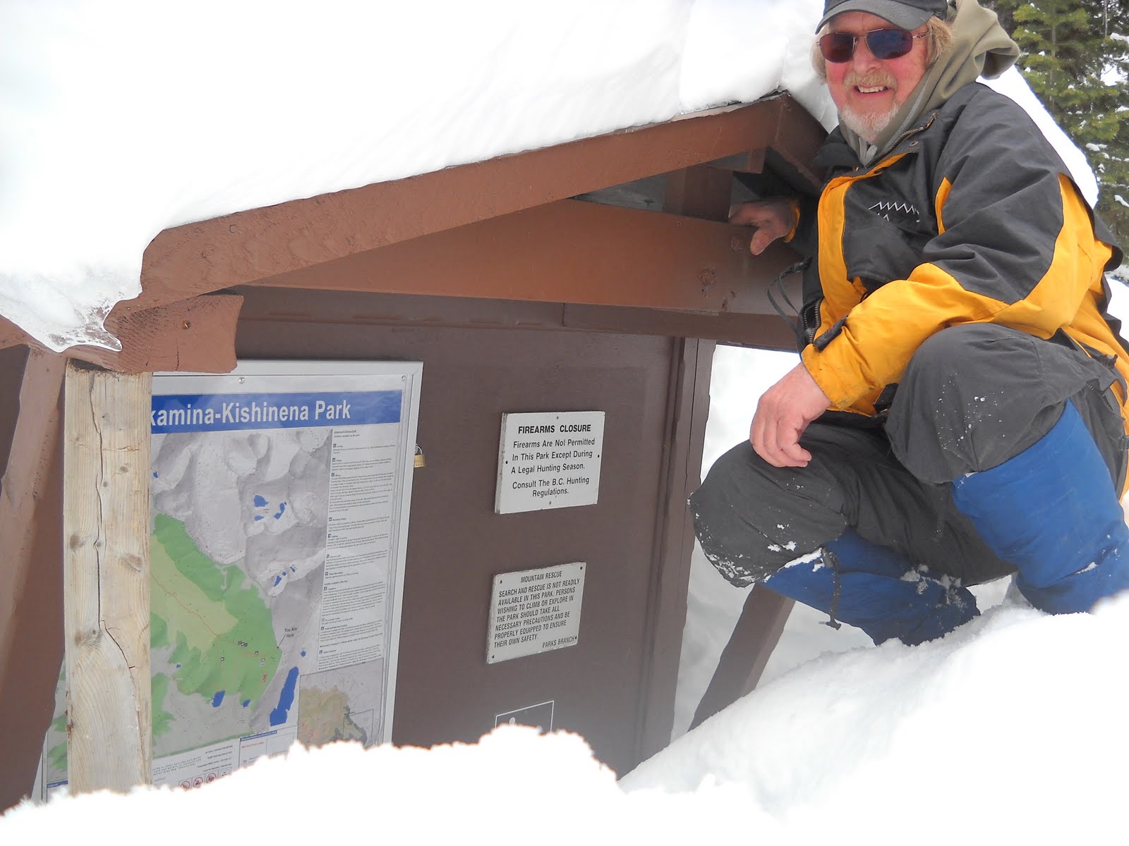
Akamina Pass in March


Solo Cross Country Ski March 24. 2011

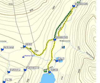
Vehicle to the Akamina Trail Head 1.5 km
Moving time is about 20 min

Trail Head to the Pass 1.5 km
Moving time is about 40 min.

From my vehicle to Akamina Pass
3 km
59 min. moving 10 min. stopped
3.1 km/hr moving time
total ascent 443 ft.
max. elev. 5951 ft.

Ski from Akamina Pass back to Cameron Lake road
1.5 km
18 min. 2 min. stopped
5 km/hr moving ave.

Akamina Pass to Cameron Lake and Back to the truck

6.02 km total
1 hr moving time
5.2 km/hr ave. moving time

I started to ski at about 4 pm and I skied to the trail head of Akamina pass and then I decided to ski into the pass. My time from the trail head to the pas was about 40 min.

The ski back out was a bit exciting as there was sufficient slope that I did not feel totally in control and ended up falling a few times. But the ski out seemed to be over in no time (18 min.).

I was back at the Cameron Lake road at about 5:50 pm so I decided to ski to Cameron Lake. On the way back from Cameron Lake I took the trail through the trees back to the truck. The snow conditions were ideal and the trail was fast so I got some nice gentle down hill skiing.

I got back to my vehicle just before 7 pm. This was an excellent time.

Total distance = 9 km
Total time = about 3 hours

The snow is high enough now so that you can ski over the barrier across the road.