Sunday, April 24, 2011

Blackfoot Lake Area

Total Distance as of April 24, 2011: 169 km

April 23, 2011
Blackfoot Lake Rec. Area, solo day hike.
On Heron Hollow Trail. Grouse tracks then flushed a Ruff Grouse just before the park fence. Also I must have flushed a moose out of the bush because I observed it's tracks in the snow coming out of the bush and going away from me. At the park boundary it turned and went north along the fence. I turned south toward Blackfoot Lake. Also heard two Red Squirrels early on in my walk. Observed Robins and Canada Geese throughout the day.
10:15 observed Heron colony. 4 or 5 Canada Geese perched on the nests. Was walking along the shore and I saw a Great Blue Heron flying toward the colony. It landed about half way up in a central tree. I observed it through binoculars as it worked on building its nest. I have never observed a Great Blue Heron building it's nest so this is a first. I watched for a bit and then moved on further west and then a second Great Blue Heron flew in and landed near by. I could not determine if they were a breeding pair but I am assuming that they are. As I walked more to the west end of the lake I saw 2 swans. They were engaged in their courtship ritual. There was a third swan further to the west on the lake. 3 swans are all I saw. There were a number of other ducks on the lake including goldeneyes.
I crossed the fence into Elk Island National Park and walked south along the park fence. I saw fresh bison and moose tracks. When I got to the SE corner of the park there were fresh tracks in the softening snow. Beside the tracks was something that looked like a beetle. I took a photo and then rolled it over and I realized that it was a bloated tick. When I saw the moose tracks earlier in the day I had noticed small amounts of blood in the snow and now I understood where the blood was coming from. The moose must have ticks on them and they are rubbing against anything they can to get the ticks off. This moose had just rubbed against the park fence and consequently dislodged the bloated tick that was laying on the snow. There must be a little bit of bleeding when the ticks are dislodged and hence the blood in the snow. About this time of day, early afternoon , I saw a few Morning Cloaked Butterfies. For the most part all trails are covered by a very packed snow cover. Walking in the morning the snow was frozen but by the time I finished my walk, about 2 pm, the snow was softening. There were a few places where I could walk along the edge of the trail on bare ground. Last year I observed a frog on April 22 in this same area but on this walk I did not see or hear any frogs.

Total distance: 11.6 km
Moving time: 3 hours 54 min
Stopped time: 1 hour 50 min
maximum elevation: 2418 ft

April 20, 2011
Walk, Mill Creek Ravine with Doran.
Started at 95 street and 86 ave. Walked down into the ravine and followed the creek to the north end where it then goes under ground.
It is apparent that the main flood event is past as most of the creek is now open water and there is significant silt deposits on the shore ice.. There is however, some areas where the creek is still covered with ice. There is still a significant amount of snow in the tree areas and on the trail.

Total distance: 3.8 km
Moving time: 1 hour 13 min


April 12, 2011
Walk, east shore North Wabasca Lake, Solo.
This was kind of a spontaneous walk. I was told there was a cross country ski trail maintained at Fisherman's Wharf. Since it had snowed some the night before I went to see if there might be a chance for a ski. Skiing was not possible so I went for a walk instead. I started out on a vehicle track and then I walked the shore line. Crossed an iron spring. I came to a sandstone cliff. There was a remainant of a crucifix panted on the cliff so I climbed up to check it out. I continued on around the shore to the point on the lake. On my way back I walked along the top of the cliff. There is a lot of brush that makes the walking difficult. I came to a place with ribbons and fabric tied to 4 or 5 trees. This is similar to other native ceremonial sites that I have seen. I picked up my requisite bag of plastic and metal garbage from along the lake.

Total distance: 5.7 km
Moving time: 2 hr 19 min
Stopped time: 53 min
430 ft. Total ascent.
2245 ft max elev.

April 3, 2011
walk in the river valley with Doran.
Started at the Legislature Buildings and walked west along the river to 149 street and back to about 99 street and then to the LRT station on 130 st.

Total distance: 15km

April 1, 2011
Urban walk to Safeway
Total distance : 3.8 km
Total time: 45 min.

Friday, April 1, 2011

Riverlot 56 Natural Area

Thursday, March 31, 2011

Riverlot 56 Natural Area


March 31, 2011

I discovered another Natural Area yesterday and it is within the City Limits of St Albert.

Apparently volunteers groom the cross country ski trails on this Natural Area so I tried it out. By yesterday evening the snow was quite soft so I decided to go skiing early this morning. Morning was a good time to go because the snow was solid and the trail was fast. There are a lot of foot prints on the trail indicating that the trails get a lot of pedestrian traffic as well. In fact I met one jogger during my ski. There are a couple of steep inclines on the trails which gave the track a bit of a challenge for a skier like me.

There are a lot of information sign post on the trails. I would say that this is one of the better maintained Natural Areas but then it is pretty much in an urban area.

I saw a couple of snowshoe hares and a red squirrel as well was some sign of a porcupine. There is a sign posted at the entrance that says "leave your pets at home" but judging from the tracks not every visitor complies with the request. There are a lot of dog tracks on the trail.

It was a pleasant surprise to find a groomed ski trail so close to an urban area.

Anyway the stats for this ski are:

Total distance 3.56 km
Moving Average 3.9 km/hr
Moving time 55 min

Later in the day I drove out to the Flying Shot Lake trail in Elk Island Park. I didn't walk far down that trail before I encountered a Bison. I found the trail has a considerable amount of snow cover, there is no ski track so walking it would likely be the best option and snowshoes would be advisable for a few more days at least.

Then I drove to the Blackfoot Lake Recreational Area. It was mid afternoon and the snow had softened quite a bit. There is still a visible ski track on the Whitetail and Gasline trails. I just hiked them as the snow was still firm enough to walk the trail.

Distance covered was about 2 km in about 45 min.


Friday, March 25, 2011

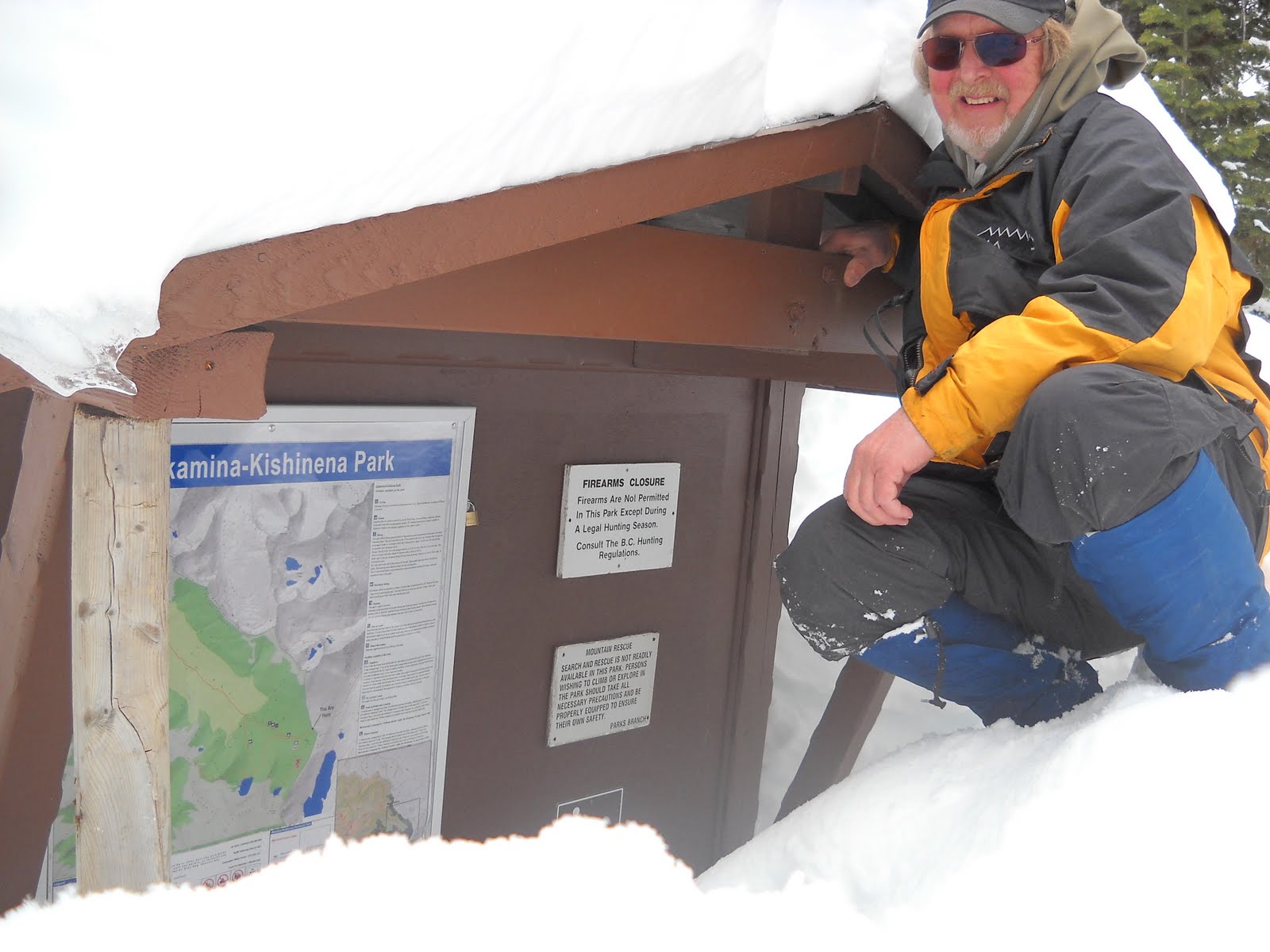
Akamina Pass in March


Solo Cross Country Ski March 24. 2011

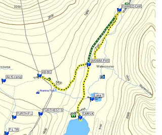
Vehicle to the Akamina Trail Head 1.5 km
Moving time is about 20 min

Trail Head to the Pass 1.5 km
Moving time is about 40 min.

From my vehicle to Akamina Pass
3 km
59 min. moving 10 min. stopped
3.1 km/hr moving time
total ascent 443 ft.
max. elev. 5951 ft.

Ski from Akamina Pass back to Cameron Lake road
1.5 km
18 min. 2 min. stopped
5 km/hr moving ave.

Akamina Pass to Cameron Lake and Back to the truck

6.02 km total
1 hr moving time
5.2 km/hr ave. moving time

I started to ski at about 4 pm and I skied to the trail head of Akamina pass and then I decided to ski into the pass. My time from the trail head to the pas was about 40 min.

The ski back out was a bit exciting as there was sufficient slope that I did not feel totally in control and ended up falling a few times. But the ski out seemed to be over in no time (18 min.).

I was back at the Cameron Lake road at about 5:50 pm so I decided to ski to Cameron Lake. On the way back from Cameron Lake I took the trail through the trees back to the truck. The snow conditions were ideal and the trail was fast so I got some nice gentle down hill skiing.

I got back to my vehicle just before 7 pm. This was an excellent time.

Total distance = 9 km
Total time = about 3 hours

The snow is high enough now so that you can ski over the barrier across the road.

Wednesday, March 23, 2011

Transitions


March 20, 2011

I went skating in Hawrelak Park. I was pleased to find the ice there was still intact. There have been some years when the skating was over by March. But the ice was in poor condition as it was rough and it seemed very soft. I only skated for about 20 min and managed to do a couple of km in that time. I expect that this will be my last skate at this park for this season. I did find it a bit curious to be sharing the ice with Canada Geese. I assume these are geese returning to the north and looking for open water. There wasn't much open water, just a couple of puddles along the edge of the pond. The geese were subjects for more than one photographer though.

March 22, 2011

I made a stop in Calgary and found myself following signs to Beaver Dam Flats Park. I have never been to this park before so I did an exploratory walk. The park is on the east side of the Bow River and south of the Deerfoot Trail. My walk took me to the Calf Robe Bridge on the Deerfoot Trail and back, a walk of about 1 hour and a distance of about 4 km. I saw the first Gull of the season.

Thursday, March 17, 2011

To Go Where Noone Has Gone Before


March 15, 2011
Ski North Wabasca Lake/Willow River, solo
8.5 km
2 hr. 56 min.
15 min. Stopped
I intended to go ski for a couple of hours but it turned out to be a little longer.
Just as I started out I was joined by two dogs. One dog had one light colored eye and one dark colored eye so I called him Crazy Eyes. They accompanied me for the entire time. When I started out on the lake I broke trail for about the first 600 metres and then there were snowmobile and vehicle tracks to follow about 1.9 km. I noticed that there are far fewer snowmobile tracks on the lake now. I am guessing that deeper snow and drifting snow is somewhat of a barrier to all vehicles now. Also noticed that the snow has not been plowed off of the vehicle trails. There are several new Ice-fishing shacks just off the point of the Wabasca Town-site. I made good time to where I had explored the Willow River north channel on a previous walk. Then I left the tracks and broke more trail in a southeasterly direction to a second channel of the Willow River about 1.4 km. 950m on the Willow River. This seems to be a more well defined channel and I intend to revisit this area in a canoe sometime during the summer. My intent was to ski up the channel and then ski north back to the lake on the north channel but I missed the north channel. I skied up the low bank of the river and from there I could see back to Wabasca so I decided to Bee Line it straight back. Here is where I got into some deep snow. I had to break a lot of trail, 1.4 km. I think that I was on a Sedge Bog. I am sure that I am the only human to have crossed that marsh this winter and perhaps in the last several years. I enjoyed watching the dogs sensing rodents under the snow and pouncing and digging at them. Having a dog around gives me a greater sense of what is going on around me as the dogs smell, hear and see things that I do not. They were good company. I almost floundered in the snow a few times but then the 'going' improved. Once I got back to the open lake I was able to continue to fallow existing tracks again for about 600m. One thing about existing tracks though is that they never go exactly to where I want to go so that makes for a lot of course corrections and for crooked Track Files. Once I got back to the the Town-site I took off my skis and walked back to my starting point about 1.2 km.

Tuesday, March 8, 2011

Momentum


March2,
Walked about 2 km just to catch the LRT downtown and back.

Saturday March 5,
Saturday afternoon I went skating. First I went to William Hawrelak Park. One circuit around the pond there is about 1 km. The ice on the pond is in fair to good condition, meaning that it has rough areas but it can be skated without too much difficulty.
In Hawreluk Park I skated 6.5 km in about 30 minuets. My average speed was 10.3 km/hour

From there I went to the Victoria Park rink. The ice at Victoria Park is generally better maintained because it is where the speed skaters practice. The ice at Victoria Park was good to very good. I was able to maintain an average speed of about 12 km/hour for just under 30 minutes and I skated another 6.5 km.

Total distance = 13 km

Monday March 7,
In the afternoon I went to Rundle Park.
I skated 10 km there.

Tuesday March 8,
Blackfoot Lake Recreational Area
Today was a good day for cross-country skiing. It was a sunny day with little wind. The ski trails in this rec. area are well defined and in good condition. I started out at the Blackfoot Lake Staging Area. I started out on the Whitetail Trail and skied to the Springs Trail. Then I skied the Springs Trail to the Heron Hollow Trail. I skied down the Heron Hollow Trail to the Elk Island Park Boundary then I skied south for a short distance along the park fence until I came to Blackfoot Lake. Next I skied the lake out to the island where the Great Blue Heron colony is. From the colony I continued down the lake to the end of the island. I then looped back north and returned to the Heron Hollow Trail. I then returned to the staging area the same way I came.

While skiing on the defined tracks I was able to maintain an average speed of about 5 km/hour but once I got to the Park Fence there was no trail so I had to make my own trail. Breaking trail slowed me down considerably. In some areas the snow held my weight and skiing was reasonably easy but in other areas I sank into the snow that was at least 1 metre deep. Progress in the deep snow was indeed slow.

Total distance = 6.5 km
Time = 2 hours moving 35 min stopped
Average speed = 3.3 km/hr

The total distance for this entry = 31.5 km

Total to date = 100 km

Thursday, March 3, 2011

March 1, 2011

Urban walk solo because it was too cold to start my vehicle. -20 something C.
South Edmonton
about 4.5 km