Thursday, July 21, 2011

Hargrave Lake/ the Cave/Mum Basin


June 30, 2011, Day 4 of Mount Robson Park, Berg Lake Hike.

To get to the Hargrave Lake trail head requires hiking back along the Berg Lake trail for about 1.6 km. The weather was a little better on this day and I think we made our breakfast under the Tyvek Fly. Even though we had some clear sky and sunshine the top of Mount Robson was still shrouded in clouds. Jim and I started our hike at 8:30 AM.
As Jim and I hiked back along the Berg Lake trail I happened to notice 5 Harlequin Ducks loafing on a rock. We stopped to observe them and I was even able to take a photo and a video of them. Then we noticed a few more loafing on a rock near the first one. There were 10 ducks in total.
I had hiked the Mum Basin and Toboggan Falls in June 2001 with Jim and Ken but we did not get to Hargrave Lake on that hike.
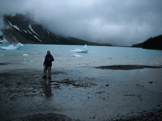
Once we started on the Hargrave Lake trail it was a steady climb. The Berg Glacier is a calving glacier meaning that chucks of ice break off and fall into the lake to form Icebergs on the lake. On the way up there was a loud rumble of a Berg breaking. I immediately looked and saw broken chunks of ice tumbling down the edge of the glacier and seconds later I heard a secondary rumble. I kept wondering why I hadn't seen larger chucks breaking off. Later in the day while at the Mum Basin I heard a loud rumble of breaking ice and when I looked at the lake I noticed new icebergs in the lake and waves radiating outward from the toe of the glacier. This confirmed what I had been thinking, which was simply that light travels faster than sound. By the time I heard the sound of the rumble of the breaking ice the event was already over as it would have taken several seconds for the sound to reach me. The waves on the water validated that a calving event had occurred within those seconds of time.
Much of the hike to Hargrave Lake is along the Lateral Moraine left as the glacier shrank in size. I speculate that when the distance between the two lateral moraines were filled with ice the Hargrave Glacier would have been as large in width and length as the Athabasca glacier is now. Walking along the moraine gives one a commanding view of Berg Lake, Hargrave Lake, and the glaciers all framed in rocky slopes and craggy mountains. As Jim and I reached the view point for Hargrave Lake we were over taken two younger hikers. One was a student of geology at the U of A. The other was an engineering student at Bristol University.
We then decided to continue on up to the cave. This is a steady ascent. We saw 2 eagles soaring over the ridge high above us. There were more people at the cave and they went into the cave. Jim and I stayed outside as their description of the interior of the cave was sufficient for us. We had a few snacks here and a bit of a rest. It was very enjoyable visiting with other hikers. The trail from the cave to the Mum Basin is not well defined but it was sufficiently clear for us to follow, however this might not be so had there been any snow or perhaps even on a day with low contrast light. The alpine flowers were out in abundance. A white crocus like flower was just one of many. A person could easily spend many pleasant hours with reference book in hand identifying flowers. There was a significant amount of 'old' snow on the trail but not enough to impede our progress in any way. Where signs of the trail were masked by the snow then there were tracks of the hikers who had been there before us to guide the way.
As we descended from the Mum Basin we saw a Clark's Nutcracker. Seeing it served to refresh my memory about the differences between the Clark's Nutcracker and the Gray Jay or Whiskey Jack.
At some point during our descent to the Robson Pass Campground Jim loaned me one of his walking poles. I found it to be a help went descending steeper trails.
We were back at camp by 3:30 pm.

Total distance hiked: 12.1 km
moving 4 hr.s 20 min
sopped 2 hr 34 min
total ascent 3355 ft.
Max. elevation 7037 ft.

My notes for June 25, 2001 record that we did the Mum Basin hike in fog and snow. During lunch we observed 2 marmots playing and also an eagle soaring above us. I also mentioned the abundance of flowers including the white crocus.
Monday, July 18, 2011

Robson Glacier, Adolphus Lake Day 3


June 29, 2011Day 3

Day 3 was a day of trying to stay dry and getting warmed up. there was a lot of contemplation and some discussion about suitable apparel in wet conditions.
We left the Berg Lake Campsite early in the morning and hiked to the Robson Pass Campsite. There are a couple of routes to the Robson Glacier. One follows the river and the other starts at the Robson Pass Campsite. There is a sign on the first trail showing where the Glacier was in 1911. The glacier has receded a couple of kilometers since then. There was even a noticeable difference in the position of the glacier now and where it was when hiked to it 10 years ago. The two photos taken from the Mum Basin do not show a significant difference but when you hike there it is noticeable. The trail to the glacier is well defined for the most part except where it gets into some rock and talus. It is then marked with cairns. We did manage to lose the trail for a short way but a quick check of our Track File had us quickly back on it. Jim found his walking poles of great advantage on this terrain particularly since a constant rain made the rocks wet.
Ten years ago while walking the glacial moraine we found a log partially buried in the moraine. I concluded that the tree must have be trapped in the glacier as it was advancing and then released from the ice as the glacier receded. At that time we quizzed the Park Ranger about this and he said that indeed some scientist had studied the tree wood and determined that it had be trapped in the ice for 3000 years. I studied this wood more carefully this time and it is still quite solid but I could detect no odder of spruce or pine and the heart of the wood has a faded hue to it.
I also noticed numerous small flowering plants establishing themselves on the glacial moraine.
Another curiosity was the milky look of the water in the river and to me it took on a rather unique greenish hue.
In spite of the rain this was a worthwhile hike.

This hike was 8.2 km. and about 3 hours 45 min. long.
Total ascent was 902 ft.
Maximum elevation 5639 ft.

We stopped for lunch at about 1 pm at the campsite where there is a shelter and fire wood, though we did not light a fire, and a tarp fly over the picnic tables. It was comfortable enough place to rest and eat. We then hiked on to the boundary between BC and Alberta and then on to Adolphus Lake. The rain was upon us then and we made our way back to camp. Jim and I pondered what makes the difference between a general rain and rain showers. By the time I got back my cotton T-shirt and long sleeved shirt were wet. I rested in the tent in hopes of drying out some but I didn't really get dry and warm until I started moving around again. I think Jim and I put up a Tyvek fly.
The day before we had visited with a young fellow from Munich. He gave us some good advice about apparel for rain conditions. When he saw Jim and I dip water straight from the river into our drinking water containers he was perhaps a bit puzzled that we were not filtering our water. He said "you guys crack me up".

Total distance 4.5 km
Total time 2 hrs. 10 min.

Total distance hiked on this day was 12.7 km.

It was June 24, 2001 that Ken, Jim and I hiked to the Robson Glacier. We talked to the Park Ranger Chris and he invited us to the cabin and showed us a photo of the Robson Glacier taken in 1908. Also we stopped at the Robson Pass Campground. I noted a Clark's Nutcracker came near by and rooted around in the litter beside a tree root.

PS: I neglected to mention: while preparing oatmeal for my breakfast on the porch of the cabin a Meadow Vole appeared along the wall. It became so bold that it ventured right to my feet and picked up a few pieces of oatmeal.

Found the trail head to the Snowbird Pass but this trail does not open until July 1st.


Thursday, July 14, 2011

Whitehorn to Berg Lake.


June 28, 2011, Day 2

This park was created in 1913 by the Province of BC. The first recreational trail was built in 1913 by Jasper outfitter "Curly" Phillips. I can understand why the trail was build but I have a hard time to imagine how the tail was built 98 years ago.
Jim and I started the hike early which turned out to be a good decision because when we packed up in the morning the tent was dry. To say that the trail from the Whitehorn Campsite to Berg Lake is mostly up is an understatement. But the scenery is worth every step. I would call this a walk of waterfalls as you can always hear the falls and there are a number of places to view the falls. White Falls, Falls of the Pool and when you reach the upper part of the trail you can take a short walk to view the Emperor Falls. Jim and I pressed on, we would view the falls on the way back. After a rest at the Emperor Falls campground we continued to where the trail traverses a talus slope. Considerable resources must have been expended to upgrade this portion of the trail and the trail is relatively level and easy walking. Watch and listen for Rock Rabbits and marmots among the rocks. Rock Rabbits are the only other mammals beside we humans, that I know of, who put up hay for the winter. They do not hibernate. When you come to the alluvial deposits at the end of Berg Lake to the left is the Misty Glacier and then further along is the Berg Glacier. Berg Glacier is a calving glacier as large chunks of ice break off from it and fall into the lake. Hence the name Berg Lake.
During hike up we encountered enough rain to put on rain gear but we were fortunate to pitch the tent dry. Sometime after the tent was pitched it poured rain. Toboggan creek rose and got a bit murky. In late evening at the bridge across Toboggan Creek the water velocity was so fast that I could hear rocks being tumbled along the creek bed. There were icebergs on the lake with some very interesting shapes. There is a cabin at Berg Lake but do not count on there being any firewood for the stove in it. Someone did light the stove later in the evening and it was nice to warm up just before going to the tent to sleep.

Checking my notes from 2001 it seems to me that we took more rests during that hike. Even though Jim is older than me I still have to work to keep up with him.

There is a Park Ranger cabin just beyond the Berg Lake toward the BC-Alberta border.

The map shows the trail to be 10 km..
Moving time was 2 hr. 21 min.
The total time for us to do the hike was 5 hr. 10 min.
Total ascent was 1821 ft. Total descent was 533 ft.
The maximum elevation was 5514 ft.

Robson Park, BC June 27, 2011


Day 1

Robson Park is world class for mountain scenery. The first 11 km will get you to the Whitehorn Campsite. The campsite is adjacent to a mountain river that flows out of Berg Lake. If you like waterfalls then the trail to Whitehorn is certain to capture your interest. The Whitehorn Campsite is located in the valley of a thousand falls and indeed it is all of that. When in this valley have binoculars with you and be sure to spend an evening observing wisps of water cascading hundreds of feet down near vertical canyon walls. Evening is the best time to observe the falls as the run off from the snow melt is at it's peak by then. By morning many of the falls have become little more than wetness on the walls of the canyon.
It was at Whiehorn in 2001 that while my food bag as on the bear cache pole that a Clarks Nutcracker pecked a hole in the bag to get at some nuts. I may still harbor a little resentment toward that bird even to this day,however, there were no worries about that happening this time as food is now stored in steel bear-proof, and bird proof, boxes.

Started the hike, with Jim, from the Berg Lake Trail Head at about 11:30 AM and arrived at the Whitehorn Campsite at about 4:30 PM
My GPS had difficulty acquiring satellites so it didn't start tracking until we were about 1.1 km along on the Kinney Lake trail.
The park sign showed the distance as 11 km. (Jim's GPS recorded the distance as 11 km.)
My GPS recorded 8.4 km + 1.1(because tracking didn't start until 1.1 km into the hike) = 9.5 km
Moving time: 2 hr. 16 min.
Stopped time: 1 hr. 58 min. These values are a bit off as I am sure we did not stop that long but I have found that when I am moving slowly the GPS records an excessive amount of stopped time.
Total ascent was 1362 ft.
Maximum elevation was 3805 ft.

I am confident that 11 km. is an accurate distance.

The trail as far as Kinney Lake is well maintained, wide and is a relatively easy walk. The trail is also well used by hikers and bicyclists.
I observed many wild flowers, including some yellow columbine, along the trail. A portion of this trail is through a mature cedar rain forest. A very serene place to walk. Observed a Pileated Woodpecker on the trail. both heard it and then saw it.

Between Kinney Lake and Whitehorn campsite there were more orchids. In photographed a Yellow Lady Slipper along Kinney Lake at UTM: 11 U 353053 5884191. I was excited to see a Yellow Lady's-Slipper but by the end of the trip I had seen quite a few. They are a beautiful flower. I also photo graphed a Round-leaved Orchid (Amerorchis rotundifolia). The Round-leaved Orchid is abundant in this area.

At the end of Kinney Lake there are two ways to go. There is the level flood plain or the high bank trail. Jim and I wanted to hike the flood plain but we were not sure if the bridges were in place so we opted to hike the high bank. The High Bank has more up and down on the trail. After the end of Kinney Lake the trail consistently climbs all the way to Whitehorn. The last river crossing to the Whitehorn campsite is a suspension bridge. There is a Park Ranger cabin near the Whitehorn Campsite. By the time I got to the Whitehorn Campsite I was tired and happy to stop hiking.